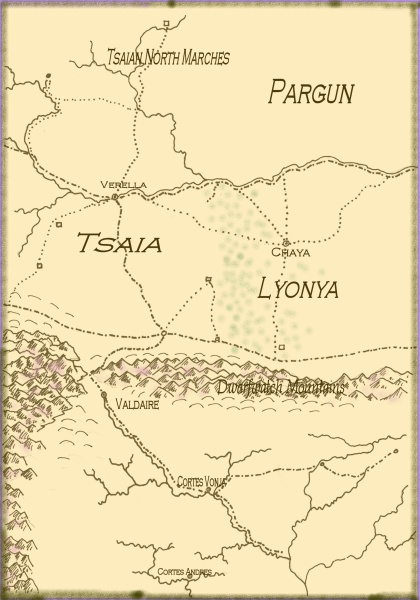
I am mastering “layers” (finally) and this has let me make an antiqued version of the current map which contains most of the information that will be on the book version, plus some that won’t. (Color helps!) this is probably (certainly?) not the final map, as I was playing with the border feature, and haven’t yet figured out how to do wiggly lettering to go along rivers, or lettering at an angle to go with non-horizontal mountain ranges and the like. But….

The big river in the north is the Honnorgat and its tributaries; the big river in the south is the Immer and its tributaries. Master Cartographer is not happy with the apprentice’s shaky hand on the border design and did not accept the excuse that it was the Mouse’s fault. Some tributaries and towns on earlier maps are not on this one.
The little square far up in the Tsaian North Marches is the Duke’s Stronghold. Fiveway has five, um, ways. Brewersbridge and Halveric Steading are east of Fiveway. The green stuff represents (very approximately) the forest in Lyonya and thus its border with Tsaia. Life is never that simple.